MEET JULIE DENNENY
 Artist Statement
“Nature is good for the soul. Through my work, I aim to connect the outside to your inside. Be it a green and gold landscape in oils, a fur or feathered wild thing in pastel on board or paddles; I remind you to look around and listen to the crickets, enjoy the ever changing sky or some sweet little living being just looking to exist.”
As an artist, and entrepreneur who loves to problem solve, share and discuss ideas Julie began drawing like every other child but so loved the joy from the expression while making others happy she continued to always do so. As a graphic designer and marketing professional her positions in small agencies gained her the experience and confidence to begin an entrepreneurial undertaking at the age of 28. Since then Julie’s creative endeavours have included art management, marketing, event planning, curating exhibits, interior decorating, gardening, painting, drawing, and living every day expressing an artistic lifestyle.
The Process – the Welcome Map
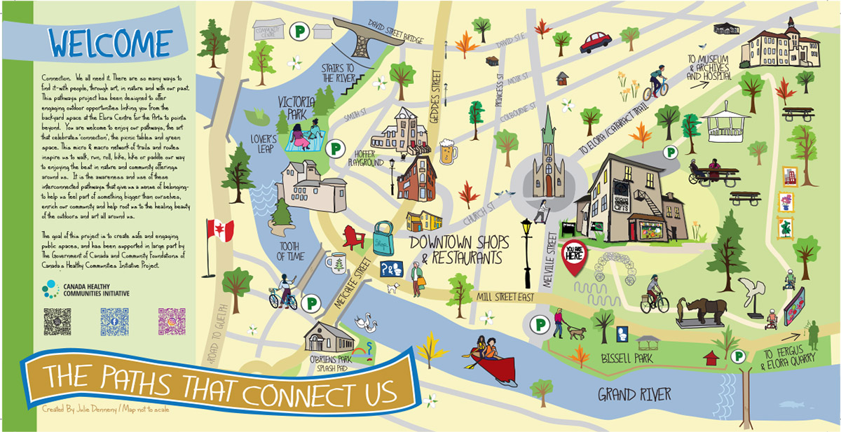
The goal of the main welcome map was to create a fun and “where’s waldo” style artist rendition of all points walkable from the Elora Centre for the Arts. We wanted to encourage folks to walk or ride their bikes to all of the points of interest around town. Each icon was drawn and placed on the map in Illustrator. The goal was to show how the Pathway on the property of the Elora Centre for the Arts connected to other pathways and neighbourhoods throughout the community.
Here’s some initial sketches and digital designs as I started to prepare the map:
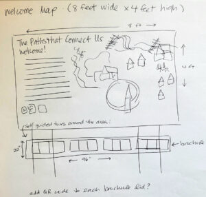

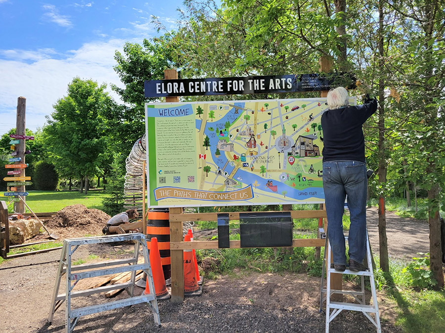
The walking map is the first thing you see as you enter ‘The Paths that Connect Us’ at the Centre. Below the map is a container with walking tour brochures from the Elora Fergus Sculpture Project, Elora Art Walk, Centre Wellington Cycling maps, and more!
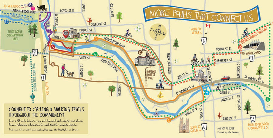
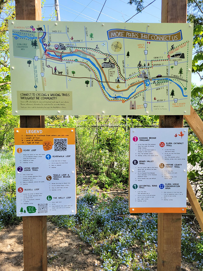
The Process – The Cycling Maps
 With the help of a local map specialist, we identified the main routes we wanted to highlight on the cycling map. It was difficult to capture all of the routes to scale, so we decided to take an artists approach and throw scale out the window – the idea was to show how many interconnected routes and trails we have right here in our community. Our map guru gave us all the details about distance to trailhead from where you are standing, level of difficulty, etc. and my job was to make sense of it and make it look beautiful!
We included QR codes so that people can go directly to the actual maps on line for more information.
This is what the final cycling map looks like!